UN
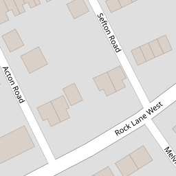
1 Acton Road
£ 78,000
Description
We don't have a Description for this property.
- Bedrooms
- 1
- Bathrooms
- 0

Leaflet © OpenStreetMap contributors
The heatmap indicates the level of crime in the area. The color of the heatmap indicates the crime severity and recency.
Metrics Year-on-Year
- Average area value
- 163,217.00 £Decreased by 7.22 %
- Average area rental value
- 594.00 £/moDecreased by 92.41 %
- Est rental Yield
- 4.37 %Decreased by 91.81 %
- Crime Rate
- 18.00 %Unchanged by 0.00 %
from 175,916.00 £
from 7,827.00 £/mo
from 53.39 %
from 18.00 %
Nearby Schools
| Name | Type | Ofsted | Distance |
|---|---|---|---|
| St Anne'S Catholic Primary School | Voluntary Aided School | Good | 0.57 KM |
| Rock Ferry Children'S Centre | Children's Centre | 0.63 KM | |
| Rock Ferry Primary School | Community School | Good | 0.70 KM |
| St John'S Catholic Junior School | Voluntary Aided School | Good | 0.99 KM |
| St John'S Catholic Infant School | Voluntary Aided School | Outstanding | 1.04 KM |
Images
Nearby Streets
| Name | Average Price | Average Sqft | Distance |
|---|---|---|---|
| Queens Road | £ 175,000 | 0 | 0.00 KM |
| Medway Road | £ 0 | 0 | 0.00 KM |
| Power Road | £ 0 | 0 | 0.00 KM |
| St Peter's Road | £ 0 | 0 | 0.00 KM |
| Shakespeare Avenue | £ 0 | 0 | 0.00 KM |
Nearby Transport
| Name | NLC | TLC | Distance |
|---|---|---|---|
| Rock Ferry | 2189 | RFY | 0.64 KM |
| Bebington | 2188 | BEB | 1.30 KM |
| Green Lane | 2218 | GNL | 1.94 KM |
| Port Sunlight | 2198 | PSL | 2.38 KM |
| Birkenhead Central | 2217 | BKC | 2.68 KM |
Nearby Listings
| Address | Price | Type | Score | Distance |
|---|---|---|---|---|
| Wilton Road, Rock Ferry | £ 142,000 | BUY | 4 / 10 | 0.10 KM |
| Flat 16, Royal Court, 30 Rock Lane West, Birkenhead CH42 1NF | £ 37,000 | BUY | Unknown | 0.10 KM |
| Victoria Drive, Rock Ferry, Wirral, CH42 | £ 180,000 | BUY | 6 / 10 | 0.20 KM |
| New Chester Road, Birkenhead, Merseyside, CH42 | £ 130,000 | BUY | Unknown | 0.21 KM |
| Melville Avenue, Birkenhead, Merseyside, CH42 | £ 100,000 | BUY | Unknown | 0.26 KM |
Nearby Properties
| Address | Price | Distance |
|---|---|---|
| 1 Acton Road | £ 78,000 | 0.00 KM |
| 12 Acton Road | £ 75,000 | 0.02 KM |
| 5 Acton Road | £ 90,000 | 0.02 KM |
| 3 Acton Road | £ 51,000 | 0.02 KM |
| 14 Acton Road | £ 47,500 | 0.02 KM |